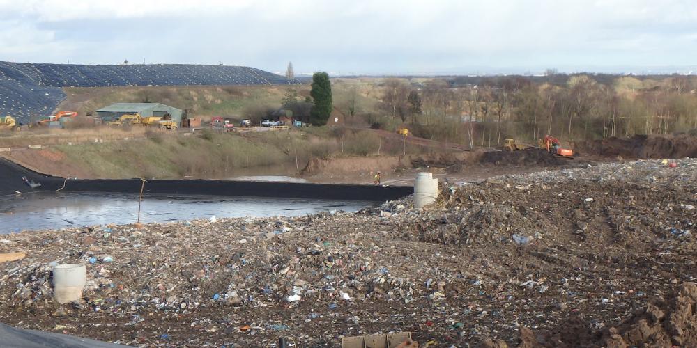
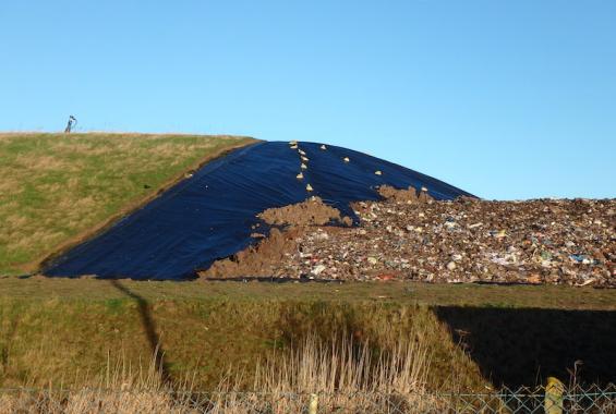
Rixton Landfill is a non-hazardous landfill that required re-permitting under the Pollution Prevention and Control Regulations. Two previous assessments (by others) failed to fully define the geological and hydrogeological setting well enough to give the Environment Agency confidence to issue a Permit for the existing landfill.
Hafren Water re-assessed large volumes of historical site investigation data, oversaw the installation of a series of additional monitoring boreholes and re-characterised the geology of the site. The resulting conceptual model was in accordance with regional hydrogeological understanding and formed the basis of detailed risk assessment modelling. A new Permit was subsequently issued for the landfill in 2009. Since that time Hafren Water has also been instrumental in obtaining revised Planning Permission for a landfill extension.
Colliers Industrial Waste Ltd originally submitted a Permit Application in 2003 for the continued operation of the non-hazardous landfill at Rixton. This was subsequently refused by the Environment Agency due to data omissions and poor understanding of the local hydrogeology.
Hafren Water was commissioned to re-assess the hydrogeology and prepare the Environmental Setting and Conceptual Model (ESID) report and Hydrogeological Risk Assessment (HRA) report together with preparation of accompanying Permit Application forms for permission to continue operating the existing non-hazardous landfill.
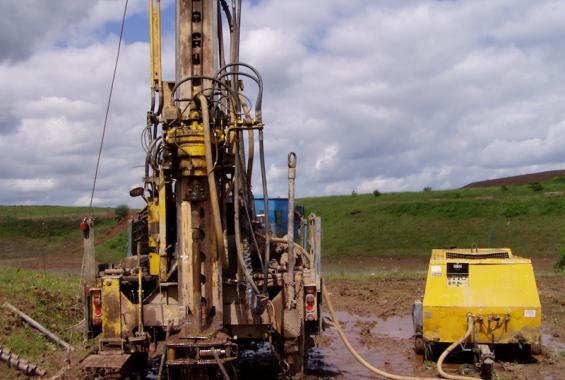
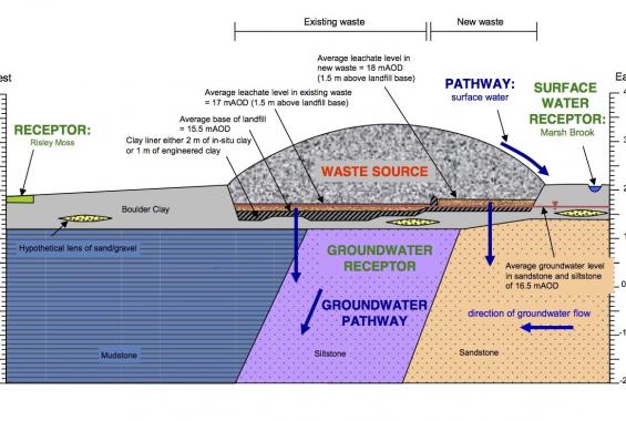
The existing body of site investigation data was reviewed and re-interpreted. The geology, Triassic Mercia Mudstone Group and Sherwood Sandstone Group, was found to vary significantly from the published British Geological Survey maps. The re-interpretation aided a better understanding of the bedrock hydrogeology and groundwater flow, which was found to be in a westward direction contrary to previous interpretations. The superficial Glacial Till geology was also re-assessed and existing understanding of groundwater occurrence expanded.
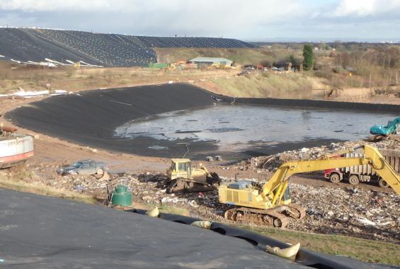
Traditional LandSim risk assessment modelling was not suitable for Rixton Landfill, as surrounding groundwater levels were above its base. The RAM3 modelling tool was used and a bespoke water balance generated for the site which included lined and unlined areas of landfill, together with areas benefitting from leachate drainage and others without.
Detailed discussions were held with the Environment Agency throughout the data assessment and modelling stages to ensure that the conceptual model, its representation in RAM3 and subsequent risk assessment modelling were acceptable.
The completed application and supporting data and reports were submitted in early 2007. After further discussions with the Environment Agency and resolution of non-technical issues a Permit was granted in early 2009.
The site has continued to operate and in 2007 and 2014 planning permissions were also successfully submitted for landfill extensions.