Outline Planning Permission was granted by Harborough District Council for the erection of 27 residential dwellings on the former Shangton Care Village site in Leicestershire. However, as the Environment Agency surface water flood maps indicated a ‘high risk’ of surface water flooding to the site a Planning Condition was included which required further information and assessment of potential surface water flood risk on site.
Leicestershire County Council are the Lead Local Flood Authority (LLFA) and acknowledged potential surface water flood risk from overland flows.
Hafren Water visited the site in order to quantitatively assess the risk of surface water flooding to the proposed residential development. We then worked together with landscape and drainage consultants in order to make sure that the proposed site layout and drainage system was designed to accommodate potential overland flows.

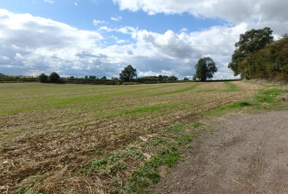
The proposed 27 dwelling development at Shangton Care Village required detailed assessment of surface water flood risk to address a Planning Condition and before the development could proceed. Hafren Water was commissioned to address the planning condition by determining the rainfall catchment upstream of the proposed development and quantify the risk of flooding to the site. Following a site walkover to identify the surface water catchment, the ReFH2 rainfall run-off method was used to calculate the critical storm duration and rate and volume of flows for a series of return periods. Hafren Water co-ordinated with landscape and drainage design consultants, who utilised our assessment in their design of a new drainage system to accommodate and safely convey overland flows away from residential dwellings.
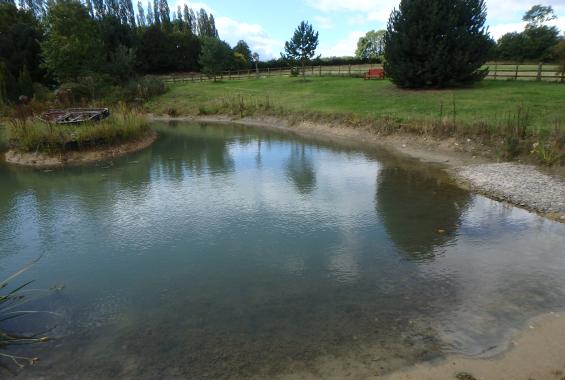
A culverted watercourse was located beneath the site, with the outfall located downstream and offsite. Two waterbodies which linked into the culverted watercourse were also located upstream of the site on third party land.
Rainfall run-off calculations were completed for the catchment, which included taking account of the influence of the upstream waterbodies. It was necessary to measure and survey the waterbodies during the site walkover, in order to determine outfall dimensions and freeboard capacities.
The calculations revealed that the proposed development site could experience flooding from overland flows and that these would need to be accounted for in the drainage design for the site.

The Flood Impact Assessment prepared by Hafren Water led to the design of a drainage system that ensures exceedance overland flows will be intercepted and captured upstream of the proposed residential development. This will be sufficient to convey flood waters from the 1 in 100 year plus climate change event from upstream of the site. Leicestershire County Council fully discharged the Planning Condition in April 2018.